

Work has been initiated on a Polish satellite offering communication services for maritime vessels.
The SAT-AIS-PL project, commissioned by the European Space Agency (ESA) will take at least 7 years and will include four phases. The first, currently initiated phase will be conducted until Q1 2017 and includes creating the mission profile and subsystem architecture.Between 2017 and 2020 in the second project phase, a system prototype will be constructed followed by the satellite itself. The third phase includes launching the mission into orbit. The last stage, foreseen to take several few years, is the operations on orbit, which also includes the satellite deorbitation at the end of the mission.
„The SAT-AIS-PL system will collect information from the Automated Identification System (AIS) needed for monitoring and safety control activities of maritime unit movement” says Michał Szaniawski, vice-president of the Industrial Development Agency. Polish and foreign entities should benefit from this system. The main users for the system and its data will be Maritime Offices, Polish Military, Border Guard), Maritime Search and Rescue Service, Intelligence Agencies and the European Maritime Safety Agency.
Task for Polish companies and infrastructure for Poland
The SAT-AIS-PL project includes a 40 kg satellite with an AIS transponder receiver for signals sent from maritime units, a ground control station, a satellite control and command center and an AIS data terminal for end users. All ground elements of the infrastructure will be localized in Poland.
„SAT-AIS-PL is the first satellite, which will be designed and constructed by a Polish science & industry consortium” says dr Grzegorz Brona, CEO of Creotech Instruments S.A. “Previous Polish satellites: PW-SAT, LEM and HEWELIUSZ, have been constructed by scientific institutions. PW-SAT was created by students from the Warsaw University of Technology, whereas LEM and HEWELIUSZ were constructed by the Space Research Centre of the Polish Academy of Sciences. Their purposes where scientific and included tests of new technologies on orbit. SAT-AIS-PL is a service providing satellite and its construction, together with the whole ground system, is much more complex and time consuming. We are proud to be able to lead this project, with close cooperation with other Polish industry and scientific entities” adds Brona.
Work on the system was initiated in 2014 through a feasibility study (within the POL-SAT-AIS project under the Polish Industry Incentive Scheme) commissioned by the European Space Agency to the following consortium: National Institute of Communications (leader), Gdynia Maritime University and the Space Research Centre of the Polish Academy of Sciences. The study was well received by ESA and the Polish Interministerial Space Policy Group (Międzyresortowy Zespół ds. Polityki Kosmicznej w Polsce), which made the decision to conduct a follow-on project named SAT-AIS-PL, to be led by an industry-scientific consortium. Since February 2015 the leader is the Creotech Instruments S.A. located in Piaseczno, close to Warsaw.
The Automated Identification System (AIS) is a short range coast system for ship tracking and collision prevention. It was designed to identify and provide information on current ship position and coast stations. AIS transponders automatically transmit this information in regular intervals. The identification and navigation data update rate ranges 2 to 180 seconds, depending on the ship movement. AIS signals are received through equipment installed on other ships or coast bases. The system is mandatory for all ships over 300 tons sailing on international waters as well as transport vessels over 500 tons and cruise ships sailing on local waters.
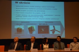
Photo presenting a slide with the SAT-AIS-PL description and project consortium representatives / Credits – K. Kanawka, kosmonauta.net, Blue Dot Solutions
„The horizontal range for the AIS system is 74 kilometers (40 nautical miles), which means that a ship located further away will not receive a signal from another ship or coast base station” explains Krzysztof Żurek from the Institute of Telecommunications. “This is due to Earth’s curvature as well as transmitter output and limited receiver sensitivity. The use of satellites allows to aggregate the AIS data from maritime unites located beyond coast base range and transmit it to the receivers. This will largely increase water movement safety” adds Żurek.
The International Maritime Organization (IMO) supervises the regulations for maritime units to equip the AIS system and the European Maritime Safety Agency (EMSA) conducts these activities on European waters. As for Poland, those tasks are conducted by Maritime Offices located in Gdynia, Słupsk and Szczecin.
The Polish SAT-AIS-PL satellite will join about a dozen other satellites currently on orbit, which transmit the AIS signal.
The new consortium is led by the Creotech Instruments S.A. company, with Hertz Systems Sp. z o.o., Atos Polska S.A, Space Research Centre of the Polish Academy of Sciences, National Institute of Telecommunications, Gdynia Maritime University and Silesian Science and Technology Centre of Aviation Industry as partners.
The SAT-AIS-PL project can be considered as an important milestone for the development of the Polish Space Industry. Building a satellite almost six times heavier than previous constructions would be a proof for the growing expertise of the entities forming the Polish space industry. It is also worth noting, that the satellite will be providing useful data for specialized services.


